
ملف:Morocco (west africa orthographic projection).svg

حجم معاينة PNG لذلك الملف ذي الامتداد SVG: 550 × 550 بكسل. الأبعاد الأخرى: 240 × 240 بكسل | 480 × 480 بكسل | 768 × 768 بكسل | 1٬024 × 1٬024 بكسل | 2٬048 × 2٬048 بكسل.
الملف الأصلي (ملف SVG، أبعاده 550 × 550 بكسل، حجم الملف: 373 كيلوبايت)
| هذا ملف من ويكيميديا كومنز. معلومات من صفحة وصفه مبينة في الأسفل. كومنز مستودع ملفات ميديا ذو رخصة حرة. |
.svg)
| الوصف |
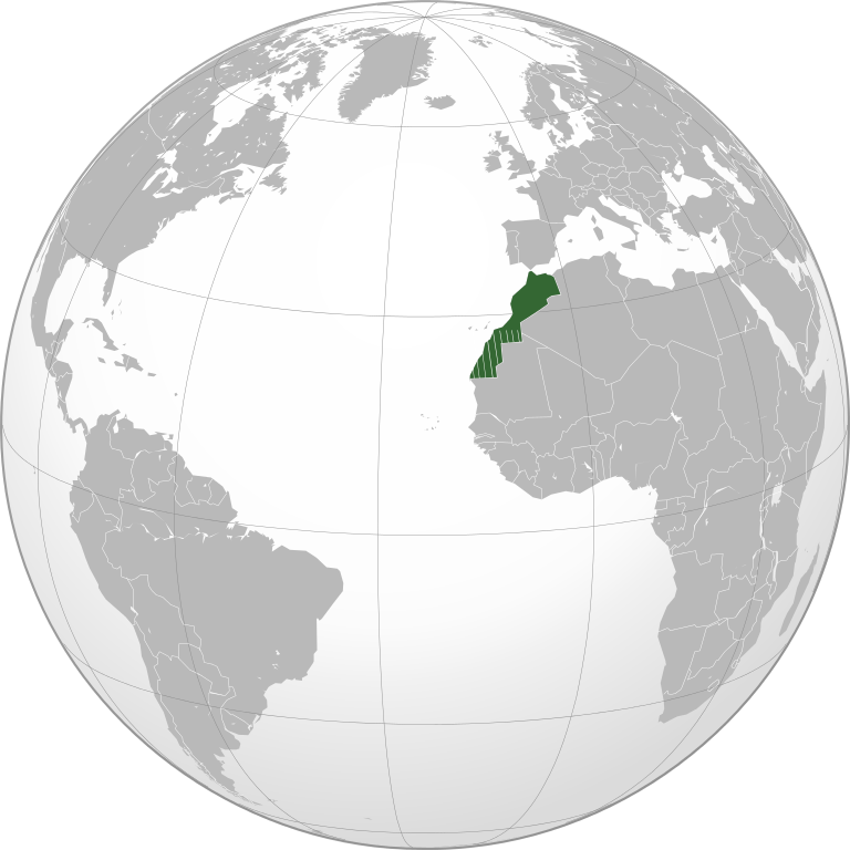
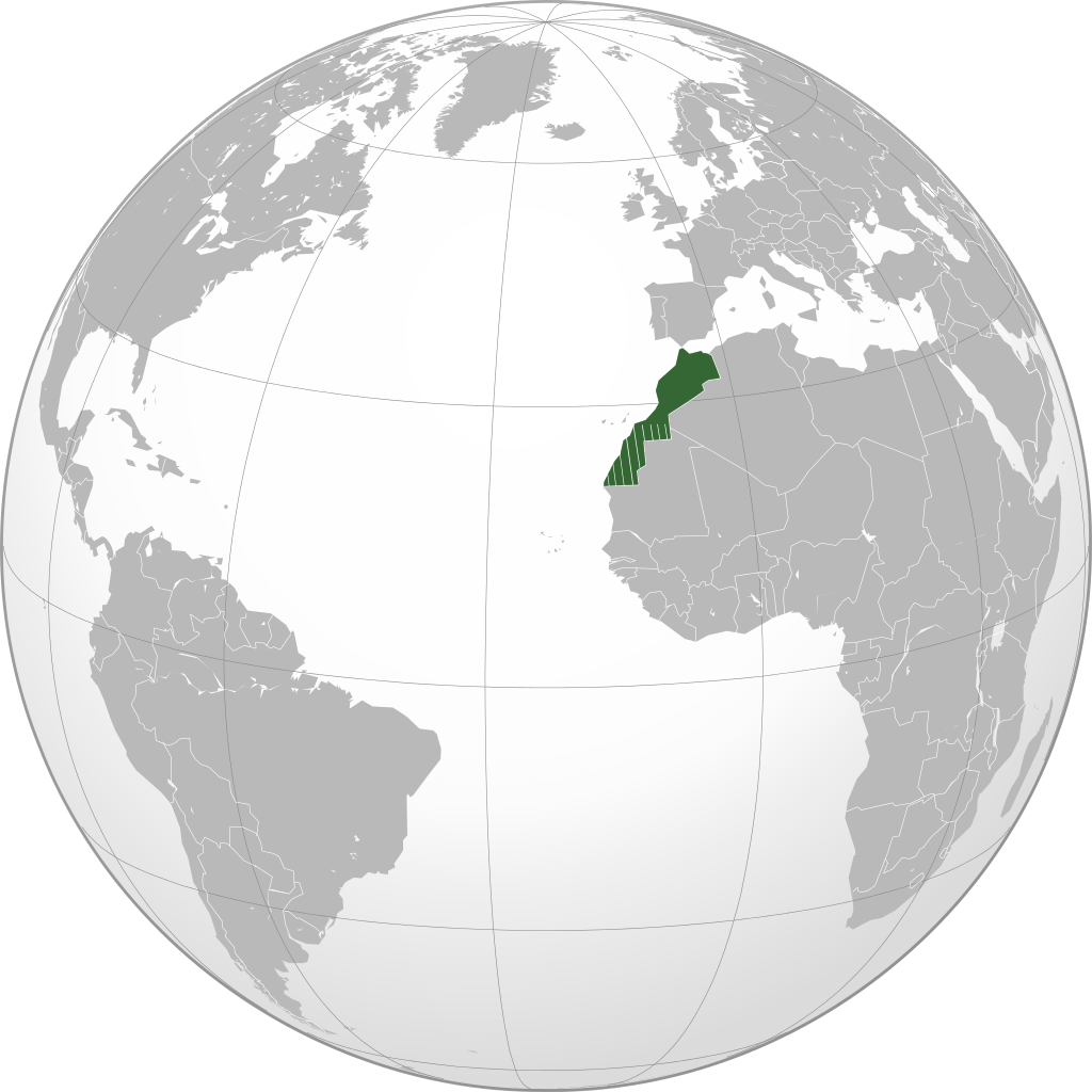
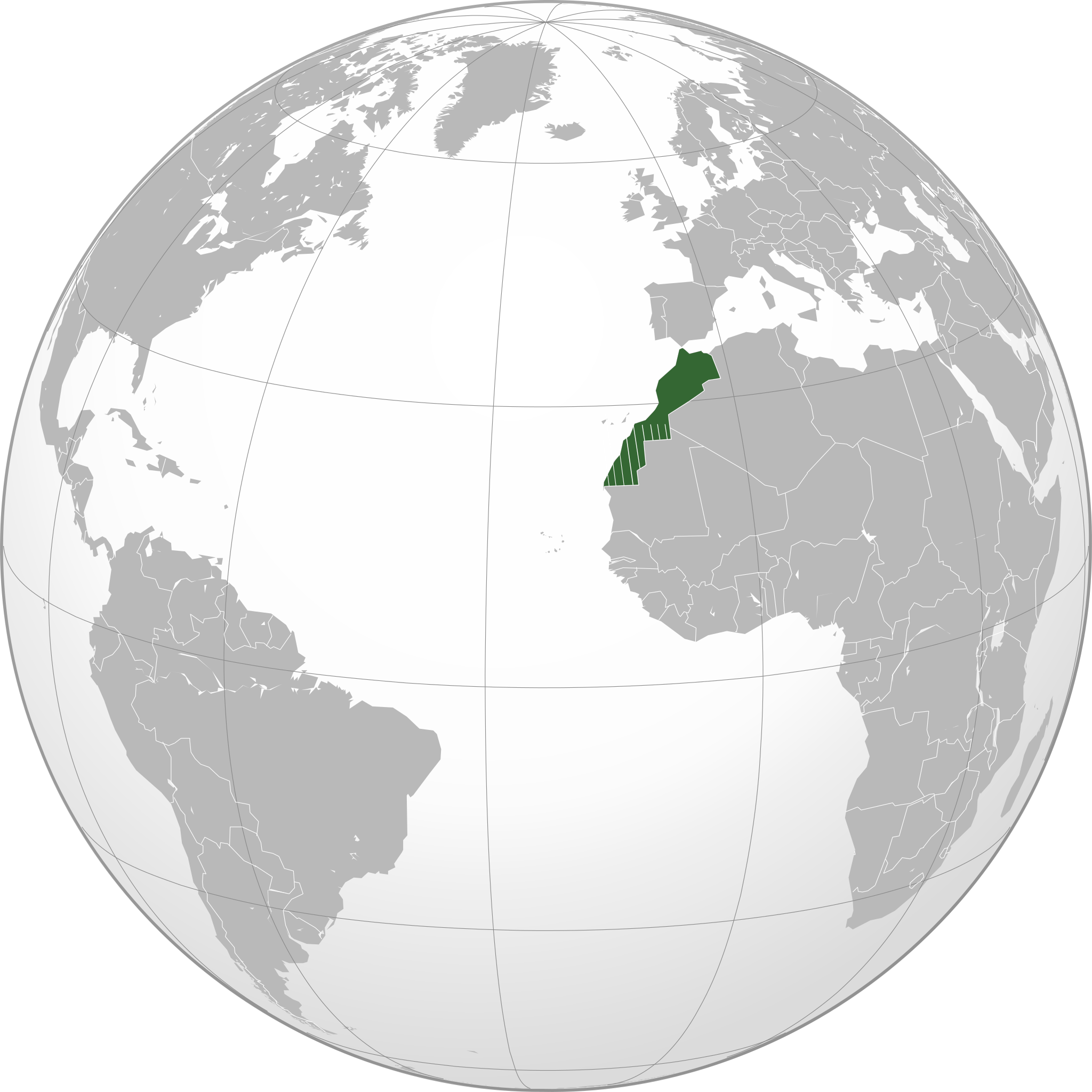
English: Locator of Morocco and its disputed territory Western Sahara shown as striped (West Africa orthographic projection). United Nations recognize Morocco as an administrative power of the territory. Report of the Secretary-General of the United Nations |
| التاريخ | |
| المصدر | عمل شخصي |
| المؤلف | Flad |
The map has been created with the Generic Mapping Tools: https://www.generic-mapping-tools.org/ using one or more of these public-domain datasets for the relief:
|

|
يسمح نسخ وتوزيع و/أو تعديل هذه الوثيقة تحت شروط رخصة جنو للوثائق الحرة، الإصدار 1.2 أو أي إصدار لاحق تنشره مؤسسة البرمجيات الحرة؛ دون أقسام ثابتة ودون نصوص أغلفة أمامية ودون نصوص أغلفة خلفية. نسخة من الرخصة تم تضمينها في القسم المسمى GNU Free Documentation License. |
تاريخ الملف
اضغط على زمن/تاريخ لرؤية الملف كما بدا في هذا الزمن.
| زمن/تاريخ | صورة مصغرة | الأبعاد | مستخدم | تعليق | |
|---|---|---|---|---|---|
| حالي | 16:01، 20 نوفمبر 2010 | | 550 × 550 (373 كيلوبايت) | Flad | {{Information |Description={{en|1=Locator of Morocco and its disputed territory Western Sahara shown as striped (West Africa orthographic projection). United Nations recognize Morocco as an administrative power of the territory. [http://www.un.org/documen |
| 15:36، 20 نوفمبر 2010 |  | 550 × 550 (364 كيلوبايت) | Flad | {{Information |Description={{en|1=Locator of Morocco and its disputed territory Western Sahara shown as striped (West Africa orthographic projection). United Nations recognize Morocco as an administrative power of the territory. [http://www.un.org/documen |
استخدام الملف
ال3 صفحات التالية تستخدم هذا الملف:
الاستخدام العالمي للملف
الويكيات الأخرى التالية تستخدم هذا الملف:
- الاستخدام في arz.wikipedia.org
- الاستخدام في incubator.wikimedia.org
- الاستخدام في zgh.wikipedia.org
.svg)