
ملف:Los Alamos aerial view.jpeg

الملف الأصلي (1٬435 × 1٬153 بكسل حجم الملف: 757 كيلوبايت، نوع MIME: image/jpeg)
| هذا ملف من ويكيميديا كومنز. معلومات من صفحة وصفه مبينة في الأسفل. كومنز مستودع ملفات ميديا ذو رخصة حرة. |
ملخص
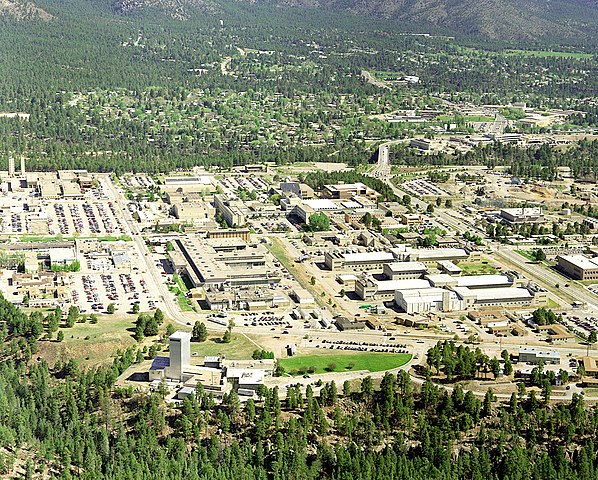
| الوصف | Aerial view of Los Alamos National Laboratory, "1995 aerial TA-3 south to north". |
| المصدر | http://www.lanl.gov/worldview/news/photos/aerials.shtml |
| المؤلف | Los Alamos National Laboratory |
| موقع الكائن | | هذه وغيرها من الصور في مواقعها على: خريطة الشارع المفتوحة |
|---|
|
هذه الصُّورة لمَوقعٍ أَو بناءٍ مُصنفٌ حالياً في السِّجل الوطنيُّ للأَماكن التَّاريخيَّة في الولايات المُتحدة الأَمريكيَّة تحت المُعرِّف 66000893. |

|
أُزيلت مَعلُومات النَّسب، نحو اسم المُؤَلِّف أو البريد الإِلكترونيُّ أو الموقع الإلكترونيُّ أو التَّوقيع الشَّخصيُّ، من على هذه الصورة ووضعت في قسم وصفها أو بياناتها. يجعل هذا استعمال الصُّورة أسهل ومناسباً لسياق مُتعدد اللغات بالإِضافة لإتاحة إمكانيَّة البحث عن النُّصوص ومعالجتها. لا يُشجِّع كُومِنز على وضع معلومات المُؤَلِّف على الصُّور بل يَستَحسِن إضافتها في صفحة بيانات الصُّورة..
|
ترخيص

|
This image comes from Los Alamos National Laboratory, a national laboratory privately operated under contract from the United States Department of Energy by Los Alamos National Security, LLC between October 1, 2007 and October 31, 2018. LANL allowed anyone to use it for any purpose, provided that the copyright holder is properly attributed. Redistribution, derivative work, commercial use, and all other use is permitted. LANL requires the following text be used when crediting images to it: (link)
Unless otherwise indicated, this information has been authored by an employee or employees of the Los Alamos National Security, LLC (LANS), operator of the Los Alamos National Laboratory under Contract No. DE-AC52-06NA25396 with the U.S. Department of Energy. The U.S. Government has rights to use, reproduce, and distribute this information. The public may copy and use this information without charge, provided that this Notice and any statement of authorship are reproduced on all copies. Neither the Government nor LANS makes any warranty, express or implied, or assumes any liability or responsibility for the use of this information. |
|
تاريخ الملف
اضغط على زمن/تاريخ لرؤية الملف كما بدا في هذا الزمن.
| زمن/تاريخ | صورة مصغرة | الأبعاد | مستخدم | تعليق | |
|---|---|---|---|---|---|
| حالي | 14:22، 26 يونيو 2011 | | 1٬435 × 1٬153 (757 كيلوبايت) | Keraunoscopia | removed watermark |
| 09:18، 8 مايو 2005 |  | 1٬435 × 1٬153 (750 كيلوبايت) | Floriang | Aerial view of Los Alamos National Laboratory, "1995 aerial TA-3 south to north", from http://www.lanl.gov/worldview/news/photos/aerials.shtml ''Source:'' en.wikipedia.org, upload by Fastfission {{PD-USGov}} [[Category:Bi |
استخدام الملف
ال5 صفحات التالية تستخدم هذا الملف:
الاستخدام العالمي للملف
الويكيات الأخرى التالية تستخدم هذا الملف:
- الاستخدام في bg.wikipedia.org
- الاستخدام في bn.wikipedia.org
- الاستخدام في bo.wikipedia.org
- الاستخدام في br.wikipedia.org
- الاستخدام في ca.wikipedia.org
- الاستخدام في cs.wikipedia.org
- الاستخدام في da.wikipedia.org
- الاستخدام في de.wikipedia.org
- الاستخدام في el.wikipedia.org
- الاستخدام في en.wikipedia.org
- Fermi paradox
- Los Alamos National Laboratory
- Theodore Hall
- Bechtel
- Albuquerque–Santa Fe–Los Alamos combined statistical area
- List of National Historic Landmarks in New Mexico
- National Register of Historic Places listings in Los Alamos County, New Mexico
- User:CM at Bechtel/Major projects table
- Draft:Triad National Security
- الاستخدام في en.wikiversity.org
- الاستخدام في eo.wikipedia.org
- الاستخدام في es.wikipedia.org
- الاستخدام في et.wikipedia.org
- الاستخدام في eu.wikipedia.org
- الاستخدام في fa.wikipedia.org
- الاستخدام في fi.wikipedia.org
- الاستخدام في fr.wikipedia.org
- الاستخدام في gl.wikipedia.org
- الاستخدام في ha.wikipedia.org
- الاستخدام في he.wikipedia.org
- الاستخدام في hy.wikipedia.org
- الاستخدام في id.wikipedia.org
اعرض المزيد من الاستخدام العام لهذا الملف.