
ملف:Montenegro Map.png

الملف الأصلي (2٬427 × 1٬807 بكسل حجم الملف: 1٫03 ميجابايت، نوع MIME: image/png)
| هذا ملف من ويكيميديا كومنز. معلومات من صفحة وصفه مبينة في الأسفل. كومنز مستودع ملفات ميديا ذو رخصة حرة. |
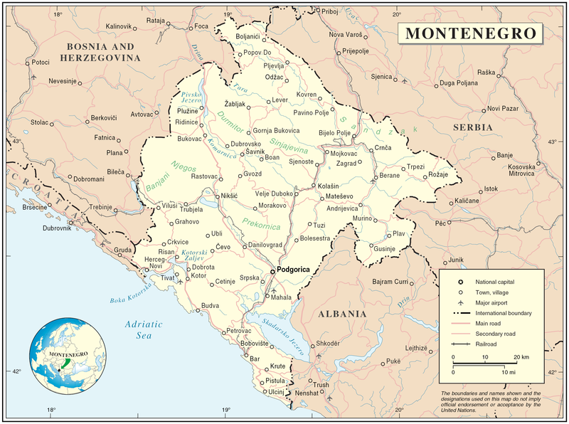
Map of Montenegro
| الوصف | Map of Montenegro | |||
| التاريخ | ||||
| المصدر | The Cartographic Section of the United Nations (CSUN) | |||
| المؤلف | Cartographer of the United Nations | |||
| الترخيص (إعادة استخدام هذا الملف) |
|

تاريخ الملف
اضغط على زمن/تاريخ لرؤية الملف كما بدا في هذا الزمن.
| زمن/تاريخ | صورة مصغرة | الأبعاد | مستخدم | تعليق | |
|---|---|---|---|---|---|
| حالي | 17:03، 10 مارس 2007 | | 2٬427 × 1٬807 (1٫03 ميجابايت) | Minestrone | Map of Montenegro {{Information |Description=Map of Montenegro |Source=The Cartographic Section of the United Nations (CSUN) |Date=2007-03-10 |Author=Cartographer of the United Nations |Permission={{Template:UN map}} and the cartographer of the UN [ |
استخدام الملف
الصفحة التالية تستخدم هذا الملف:
الاستخدام العالمي للملف
الويكيات الأخرى التالية تستخدم هذا الملف:
- الاستخدام في als.wikipedia.org
- الاستخدام في avk.wikipedia.org
- الاستخدام في be-tarask.wikipedia.org
- الاستخدام في bg.wikipedia.org
- الاستخدام في cs.wikipedia.org
- الاستخدام في cy.wikipedia.org
- الاستخدام في de.wikipedia.org
- الاستخدام في el.wikipedia.org
- الاستخدام في en.wikipedia.org
- الاستخدام في fa.wikipedia.org
- الاستخدام في fr.wikipedia.org
- الاستخدام في gag.wikipedia.org
- الاستخدام في gd.wikipedia.org
- الاستخدام في hr.wiktionary.org
- الاستخدام في ia.wikipedia.org
- الاستخدام في incubator.wikimedia.org
- الاستخدام في io.wikipedia.org
- الاستخدام في ka.wikipedia.org
- الاستخدام في la.wikipedia.org
- الاستخدام في ms.wikipedia.org
- الاستخدام في nl.wikipedia.org
- الاستخدام في pl.wikipedia.org
- الاستخدام في pl.wiktionary.org
- الاستخدام في pnb.wikipedia.org
- الاستخدام في ps.wikipedia.org
- الاستخدام في rm.wikipedia.org
- الاستخدام في roa-tara.wikipedia.org
- الاستخدام في ro.wikipedia.org
- الاستخدام في ro.wikivoyage.org
- الاستخدام في ru.wikipedia.org
اعرض المزيد من الاستخدام العام لهذا الملف.